
In satellite imagery analysis, the integration of machine learning techniques with powerful platforms like Google Earth Engine (GEE) has opened new avenues for understanding our planet. One such technique is the Random Forest (RF) classification, a popular machine learning method known for its accuracy and efficiency. When applied to Sentinel-2 imagery within GEE, it provides a potent tool for various geospatial analyses. This blog explores the importance and uses of Random Forest machine learning classification in GEE, specifically using Sentinel-2 data.

Understanding Random Forest Classification
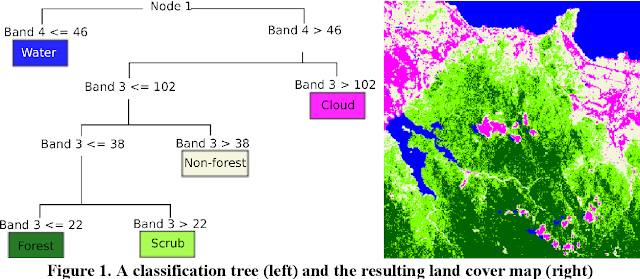
Random Forest is an ensemble learning method, essentially a collection of decision trees, each contributing to the final decision. This method is not only robust against overfitting but also capable of handling large datasets with numerous input variables, making it ideal for satellite imagery classification.
Why Use Random Forest with Sentinel-2 in GEE?
1. Handling High-Dimensional Data:
Sentinel-2 provides multi-spectral imagery with 13 bands. The RF classifier can efficiently process this high-dimensional data, extracting meaningful patterns and relationships.
2. Accurate Land Cover Classification:
With its capability to discern subtle differences in spectral signatures, RF is perfect for detailed land cover and land use classification, a critical application in environmental monitoring and urban planning.
3. Versatility and Flexibility:
RF can be applied to various tasks, from vegetation health monitoring to water body mapping, showcasing its adaptability to different types of geospatial data and objectives.
4. Efficiency in Large-Area Analysis:
Given GEE's powerful cloud-computing capabilities, applying RF to large areas becomes feasible and efficient, a significant advantage for regional or global scale studies.
5. Handling of Missing Data:
RF can manage missing values in datasets, a common issue in remote sensing. This makes it a reliable choice for dealing with imperfect satellite data.
Applications in Geospatial Analysis
The combination of RF and Sentinel-2 data in GEE has wide-ranging applications:
- Agriculture: Assessing crop types, monitoring crop health, and planning agricultural expansion.
- Forestry: Forest classification, deforestation monitoring, and biomass estimation.
- Urban Planning: Urban land cover classification and monitoring urban sprawl.
- Water Resources: Classifying water bodies and assessing water quality.
- Environmental Monitoring: Tracking changes in ecosystems and biodiversity.
Advantages in GEE
Using RF with Sentinel-2 data in GEE comes with specific advantages:
- Scalability: GEE allows for processing large datasets, ideal for RF's application on a global scale.
- Accessibility: GEE's cloud platform requires no local computational resources, making advanced analyses accessible to a wider audience.
- Speed: The efficiency of GEE's cloud processing significantly reduces the time needed for complex computations like RF.
Random Forest machine learning classification in GEE using Sentinel-2 data is a powerful combination for geospatial analysis. Its ability to handle complex, high-dimensional datasets and provide accurate, reliable results makes it an invaluable tool in the Earth observation domain. From land cover classification to environmental monitoring, the applications are vast and critical in our quest to better understand and manage our planet's resources.
Comments
Post a Comment